See the big picture before the field visit
Browse mapped existing and potentially historic wetlands and explore patterns across the landscape.
A free, open map of wetlands
Wetland Sense brings a new level of detail to wetland mapping, starting in Virginia. Explore wetland probability - existing and historic - at 3-meter resolution, analyze a site, export a report, or take the data with you.
WetlandSense brings together high-resolution wetland mapping and the surrounding land and policy context in one open, interactive map.
Model-generated mapping identifies wetlands - existing and potentially historic - at 3-meter resolution, detailed enough to support site-level decisions.
Explore wetland presence, land ownership, and regulatory context in one platform instead of piecing information together across different sources.
The map and the data behind it are public. Share it with a colleague, partner, or landowner and they can explore the same information you can.
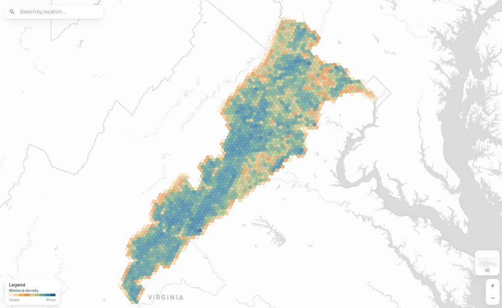
WetlandSense is rolling out one ecoregion at a time, starting with Virginia's Northern Piedmont, giving users an early look at the level of detail and functionality. Coverage will expand statewide, and ultimately, across the United States.
Whether you're exploring an entire landscape or investigating one parcel, WetlandSense lets you move from discovery to usable information without leaving the map.
Browse mapped existing and potentially historic wetlands and explore patterns across the landscape.
Search an address, zoom to the parcel, and get the full picture: wetland acreage, likelihood, parcel ownership, and applicable regulations.
Draw your project boundary, get wetland details, and export a formatted PDF with map, legend, and key metrics.
Download datasets or connect live map services in standard GIS formats (Esri, KML/KMZ, GeoJSON) for use in your own tools and services.
WetlandSense uses a peer-reviewed approach to identify wetlands at high resolution. The model brings together topography, hydrology, and vegetation, physically meaningful signals rather than opaque inputs. Because these data are available nationwide, the method can extend anywhere in the US where training data exists.
Explore the MethodologyPair at-risk wetlands with parcel ownership to prioritize where your outreach will matter most.
Screen sites early on for wetlands to avoid costly permitting surprises.
Avoid impacts and focus field surveys before boots hit the ground.
Pinpoint historic wetlands with restoration potential and connect with the landowners who can make projects happen.
We gratefully acknowledge the partners and supporters whose collaboration, expertise, and early investment helped make WetlandSense possible.